Main Business

Work Overview
Discharge measurement is aimed to provide basic data for the establishment of national plans of water resources, the management of water quantity, quality and ecosystem management, and the design of hydraulic structures.
Definition
Discharge measurement and analysis
The ground of business
Article 9 of 「Act on the Investigation, Planning and Management of Water Resources」
Notification No. 2018-95 「Regulations of the Designation and Operation of Hydrological Survey Organizations」 of the Ministry of Environment
Scope of business
Nationwide stream (National stream and local stream)
Application
water use
Flood control
Others
·Streamflow Measurement
1. Water level
Observation of reference water levels and gauged water levels (start time and end time)
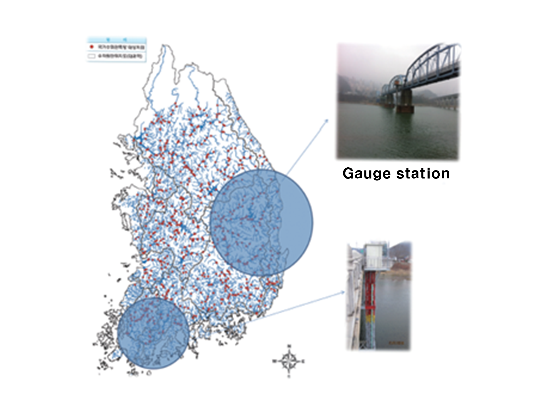
2. Discharge
Measurement with the use of appropriate measuring equipment and methods for various ranges of water levels
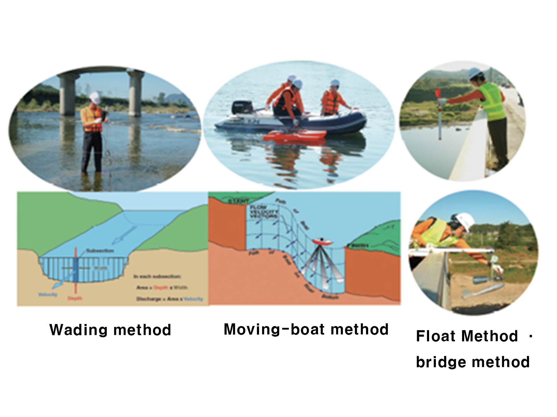
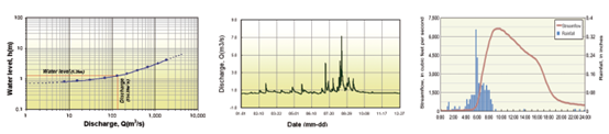
3. Rating Curve development & discharge data production

Work Overview
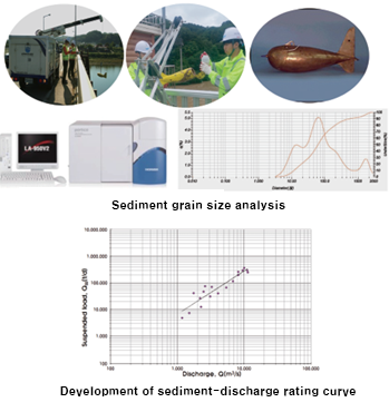
Survey of sediment discharge addresses primary data for the analysis on riverbed changes, the maintenance of river facilities, and the design of various water structures by producing sediment discharge rating curve.
Definition
Suspended sediment & bed load discharge survey and analysis
The ground of business
Article 9 of 「Act on the Investigation, Planning, and Management of Water Resources」, Notification No. 2018-95 「Regulations of the Designation and Operation of Hydrological Survey Organizations 」 of the Ministry of Environment
Scope of business
Nationwide stream (National stream and local stream)
Applications
·Sediment discharge measurement & analysis

Work Overview
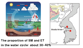
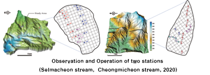
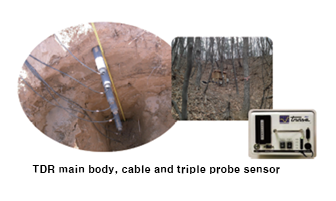
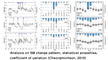
Soil moisture survey is proposed to create fundamental data necessary to runoff analysis in river basins by measuring and quantifying the soil moisture.
Definition
Soil moisture survey and analysis
The ground of business
Article 9 of 「Act on the Investigation, Planning, and Management of Water Resources」
Notification No. 2018-95 「Regulations of the Designation and Operation of Hydrological Survey Organizations」 of the Ministry of Environment
Scope of business
National river basins
Application

Work Overview
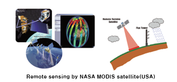
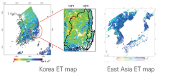
Evapotranspiration survey is designed to produce elementary data necessary for the runoff analysis in river basins and for defining a water cycle process by surveying and quantifying evaporation and transpiration in river basins.
Definition
Survey and analysis of the evapotranspiration that is the sum of evaporation and transpiration
The ground of business
Article 9 of 「Act on the Investigation, Planning, and Management of Water Resources」, Notification No. 2018-95 「Regulations of the Designation and Operation of Hydrological Survey Organizations 」 of the Ministry of Environment
Scope of business
National river basins
Applications

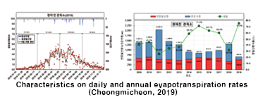
·Spatial mapping and analysis based on MODIS satellite

Work Overview
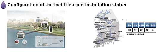
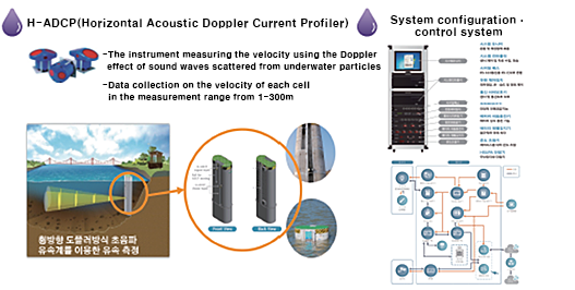
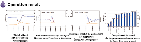
Real-time discharge measurement is aimed to observe the real time-discharge by establishing the system of the discharge (velocity) observation at the stream, canal, etc. and to develop and suggest proper measurement method considering to stream conditions.
Definition
Install and operate the real-time discharge measuring equipment to measure discharges continuously by using advanced instruments like ultrasonic velocimeters
The ground of business
Article 9 of 「Act on the Investigation, Planning, and Management of Water Resources」, Notification No. 2018-95 「Regulations of the Designation and Operation of Hydrological Survey Organizations 」 of the Ministry of Environment
Scope of business
Nationwide stream (National stream and local stream)
Application